Island in Focus – Stronsay
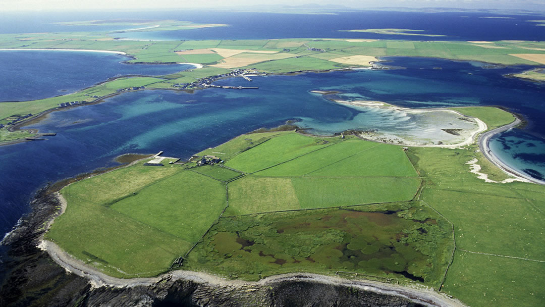
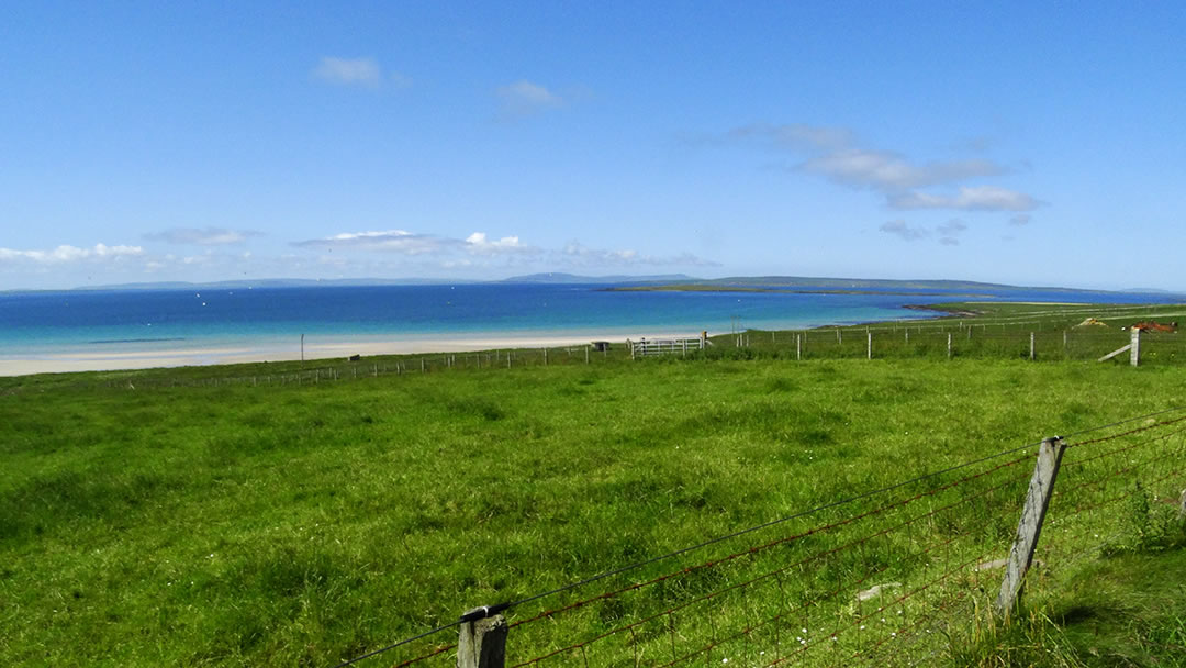
Due to its star-like shape, Stronsay has a very long coastline despite being only the seventh largest of the Orkney Islands. On nearly every side, the island is surrounded by bays with beautiful long white sand beaches, some over 1½ miles, to rival Sanday’s shores. On the south east side there are low cliffs and impressive coastal scenery including the Vat of Kirbuster and Burgh Head.
The Stronsay Beast was a 55ft-long decomposing corpse of a sea-creature found in 1808. Though some fancied that the creature was a sea serpent, others declared that it was a basking shark. However, if that were the case, it would be largest basking shark ever found!
The name Stronsay may come from the Old Norse, Strjonsey which may mean ‘profit island’, referring to the good fishing and rich green farmland found there. Most of the island is covered by well-tended fields filled with grazing cattle and sheep. The only moorland is found on the peninsula of Rothiesholm (pronounced rousam).
Stronsay can be reached by taking an Orkney Ferries ship or Loganair plane from Kirkwall. Approximately 350 people live in Stronsay, and there is accommodation for visitors, shops, and a school. We would recommend taking time to follow the Stronsay craft trail which showcases the work of the Stronsay’s creative islanders!
Early Stronsay Settlers
As the land has been farmed rigorously, few traces of the first residents of Stronsay remain. However, Stronsay’s fertile soil did attract early settlers, and two flint arrowheads discovered in 2007 on the island date from the late Paleolithic or early Mesolithic periods. This would make the arrowheads 10,000 to 12,000 years old and the earliest human artefacts found in Scotland.
There are burnt mounds at Kirbuster; several ancient settlement sites and field systems; and Iron Age brochs at Housebay (Benni Cuml) and close to the Loch of Rothiesholm (Hillock of Baywest). Kelsburgh chambered cairn, also near the Loch of Rothiesholm, is well worth visiting. At Lamb Head there is an Iron Age broch and two chambered tombs. There are many chapel sites in Stronsay associated with Norse farms though all that remains of these are place names.
Stronsay is more notable for its recent history of herring fleets and the kelp industry. There is extensive information about both below and in the Stronsay Heritage Centre in Whitehall Village.
Whitehall Village and the Herring Boom
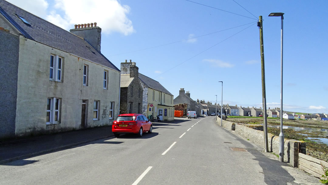
The village of Whitehall is where the roll-on, roll-off ferry service arrives in Stronsay. The area was previously known as North Strynie, but the village was named after a house built in 1671 by Patrick Fea, a retired privateer. Whitehall is now a quiet harbour village but during the Herring Boom, Whitehall was the biggest herring port in Orkney.
Previous to this, the main industry in Stronsay was exporting grain to the continent. Stronsay was known as an excellent harbour for the Dutch and Fife Boats who, since late Norse times, followed migratory shoals of herring in the North Sea.
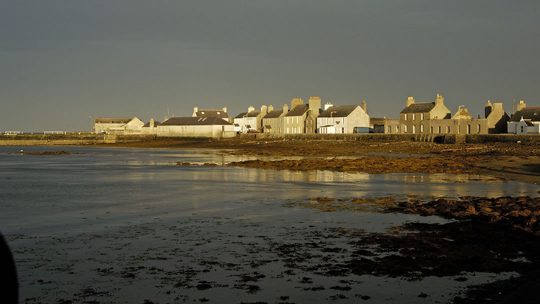
As the herring boom began in the early 19th century new piers were built in Whitehall and Stronsay islanders soon had their own fleet of 170 small boats. The village grew rapidly and by the early 20th century it was one of the herring capitals of Europe.
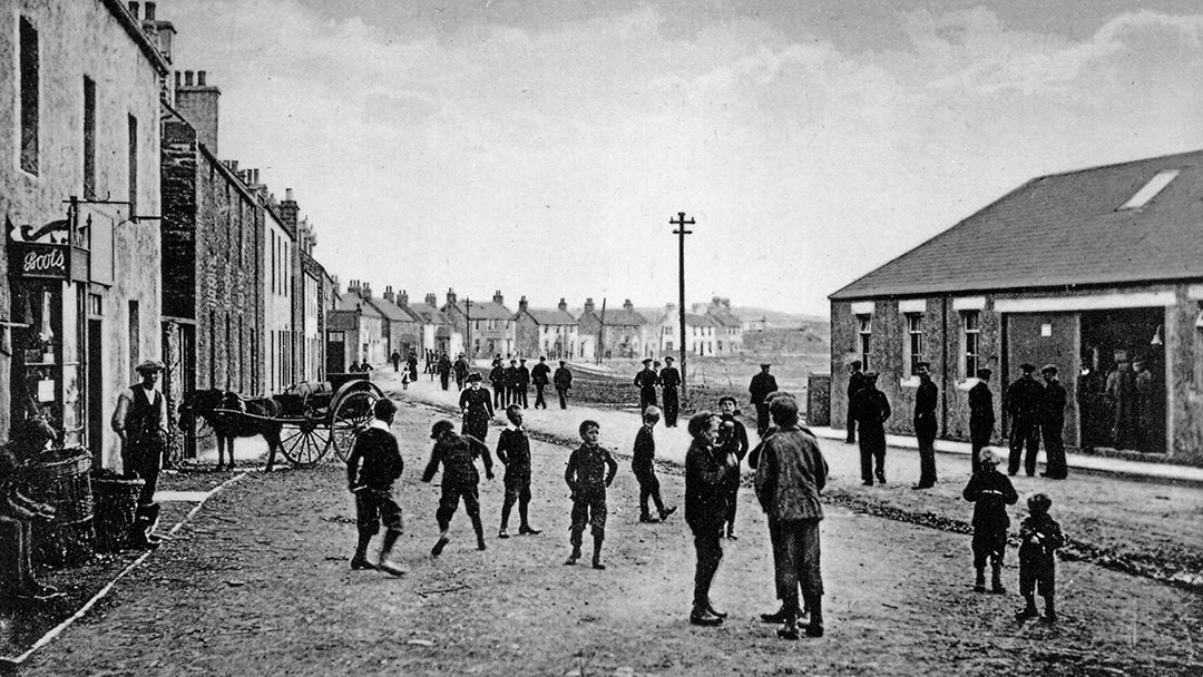
In 1913, 300 steam drifters worked out of the harbour and there were 1500 fish wives and fifteen curing stations. In 1924, over 12,000 tons of herring were landed. The herring was cured (salted) and exported to Germany, Russia, and Eastern Europe.
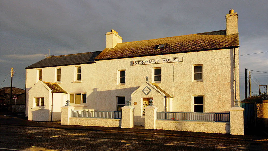
Whitehall resembles a fishing village from the North East of Scotland. The great prosperity brought in from the Herring Boom (as well as the need to house many lodgers) is obvious in the large two-storey houses here. There were forty pubs in Whitehall and Stronsay Hotel once had the longest bar in Scotland!
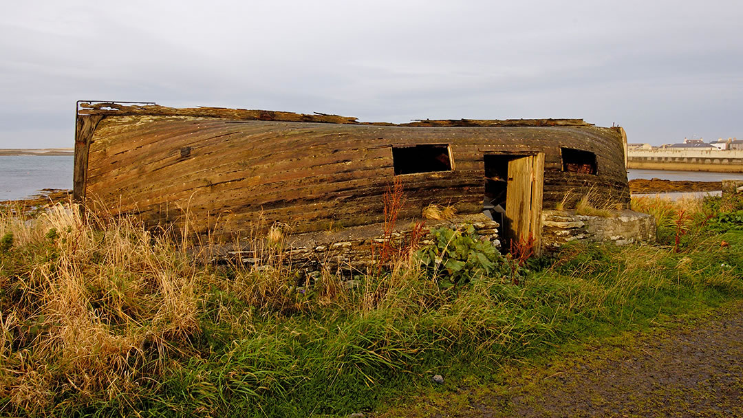
Other interesting features from the past include Lower Whitehall (which once housed the families of herring fishermen), a shed with an upturned lifeboat for a roof (which came from the SS Athenia, the first UK ship sunk by U-boat at the start of WWII), and a toilet at the west end of the village (that is flushed by the sea).
The Herring Boom ended in 1937 with overfishing and the outbreak of the Second World War. There is still some lobster fishing practiced out of the harbour, but the main economy of Stronsay has reverted back to farming.
In Whitehall today you will find accommodation, shops, a café and heritage centre. The village overlooks the monastic island of Papa Stronsay and the harbour here is ideal for visiting yachts (though care must be taken as there are reefs and shoals nearby).
Kelp Production
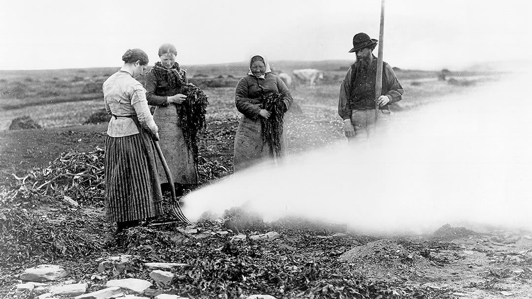
Kelp collection was also a big industry in Stronsay’s past and employed a great many islanders. James Fea of Whitehall introduced the burning of seaweed to make kelp in 1722 but initially met resistance. This occurred because islanders were terrified of the Nuckelavee, a sea monster who hated smoke, and they blamed bad harvests and poor fishing on the kelp industry.
Later generations viewed the kelp industry more positively, and the long, gentle sloping beaches of Stronsay (and Sanday) were ideal for collecting seaweed. Tang was seaweed cut from rocks at low tide and ware was seaweed washed ashore during storms.
Previously seaweed was dragged onto the fields to be used as fertiliser. To make kelp, dried seaweed would be burned on the shore in circular stone-lined kilns. This was then shipped to North East England for glass and soap manufacture and to make potash and soda.
Orkney became one of the main exporters of kelp, especially between 1780 and 1830 when supplies of potash and soda from France and America stopped because Britain was at war with those countries. 3,000 people were employed by the kelp industry in the islands and some of the profits in Stronsay were ploughed back into improving the farmland.
Kelp production collapsed in 1832 when cheaper sources became available. In Stronsay, evidence of the kelp industry, such as drying areas and burning pits dotted around the shores, can still be seen.
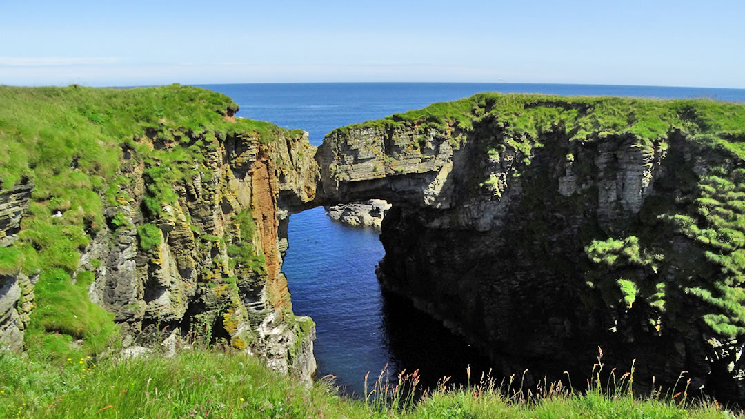
From the Vat of Kirbuster to Lamb Head
A walk to the Vat of Kirbuster, a natural arch described as the “finest in Orkney” is recommended. Stronsay’s most famous landmark is a large natural rock arch and gloup formed by a collapsed cave. This natural bridge is 20m high and 10m wide and best reached from the car park 1km away. The Vat of Kirbuster is quite a long walk from Whitehall Pier so, if you have limited time, we recommend arranging transport!
There is a fine coastal walk continuing on from the Vat around Odin’s Bay. The jagged coastline of low cliffs, geos, caves, and sea stacks through to Burgh Hill and Lamb Head is stunning. The sea stack known as Tam’s Castle has a hermitage ruin clearly visible on its summit.
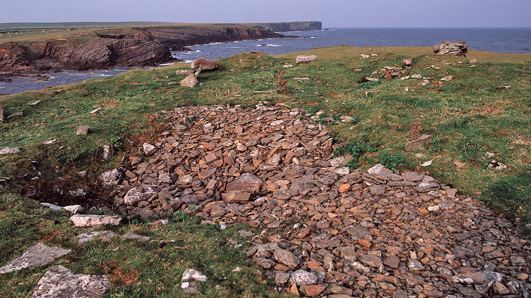
There are many interesting sights to see once you reach Lamb Ness and Lamb Head. These include two chambered cairns, a broch, the Dane’s Pier (a natural spit of stones which may have been a Norse harbour), Whale Geo (so named because in the past a whale got trapped in this narrow space), and Hell’s Mouth (a sea cave where breaking waves make a frightening sound)!
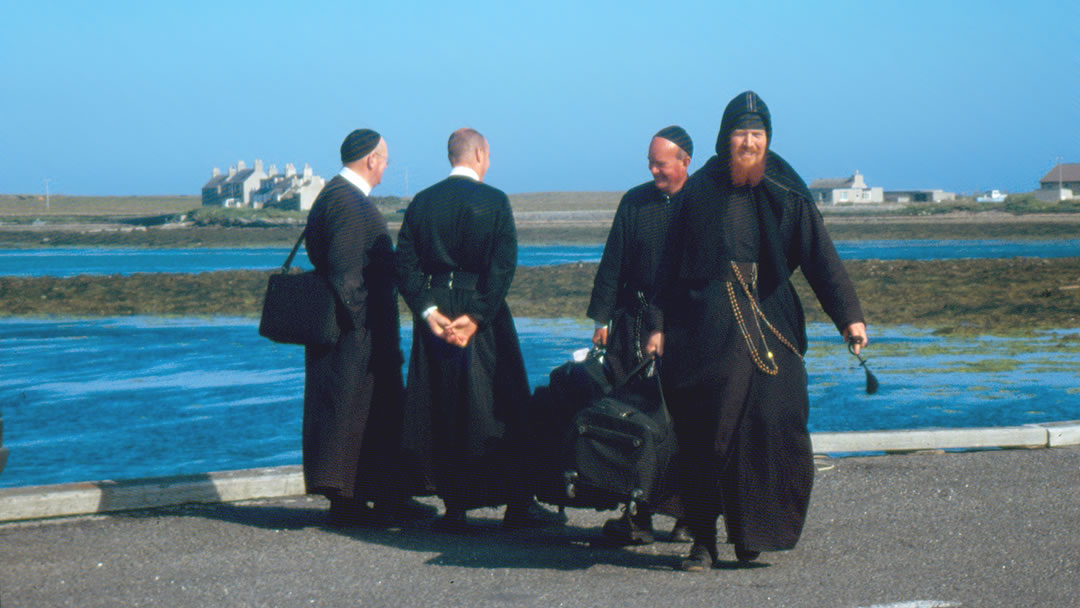
Papa Stronsay
Lying opposite Whitehall is the tiny island of Papa Stronsay. It was populated by monks of St. Columba in the past and since 1999 has been home to Transalpine Redemptive monks who live in Golgotha Monastery. Papa Stronsay has no gas, electricity, phone or water lines so water is pumped from wells that have been bored into the rock and electricity is provided by a generator.
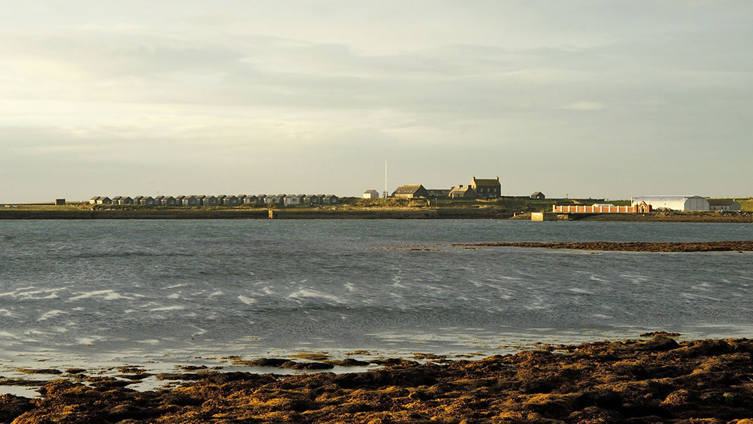
Like Whitehall village, Papa Stronsay was a busy place during the herring boom, and has piers, curing stations and a tramway from that period. Other sites of interest in Papa Stronsay include the Earl’s Knowle, which is the longest chambered cairn in the UK and the Chapel of St Nicholas which was built in 11th century. The building was demolished in 1792 and excavated in 1998.
Papa Stronsay features in the Orkneyinga Saga in 1046 when Earl Rognvald was murdered by his rival Earl Thorfinn. Prior to his death, Rognvald hid on the island. When he was discovered, dressed as a monk, he was chased and later found on the shore, revealed by the barking of his pet dog. Who said that a dog is a man’s best friend?
Stronsay beaches, seals and Linga Holm
Stronsay has fantastic beaches well worth travelling to. Some of Orkney’s rarest shells can be found here and many sunbathing seals!
Beaches to visit include the Ayre of Myers which is within walking distance of Whitehall and perfect for picnics. St Catherine’s Bay, the Sands of Rothiesholm, Sand of the Crook, and Mill Bay have beautiful long stretches of unspoiled white sand and are edged with colourful wildflowers. Mill Bay has 1.5 miles of beautiful sand and at the Sand of Crook you will find a bird hide and a seal hide, ideal for photographers!
As Stronsay beaches are usually quiet, this makes them particularly attractive to seals. Well over a thousand seals haul out around Stronsay.
Linga Holm (old Norse for heather isle) is a small island to the north west of Stronsay owned by the Scottish Wildlife Trust. It is the third largest breeding colony in the world for Atlantic grey seals and almost 3,000 seal pups are born here every year.
Linga Holm was also home to the Stronsay Fairies, and there is a ritual which involves throwing potato clippings over your shoulder to the fairies, named Alex, Dolax, Gimp, Cork, Horny and Keelbrown. It was considered bad luck to turn around to see if the clippings were gone!
Birds of Stronsay
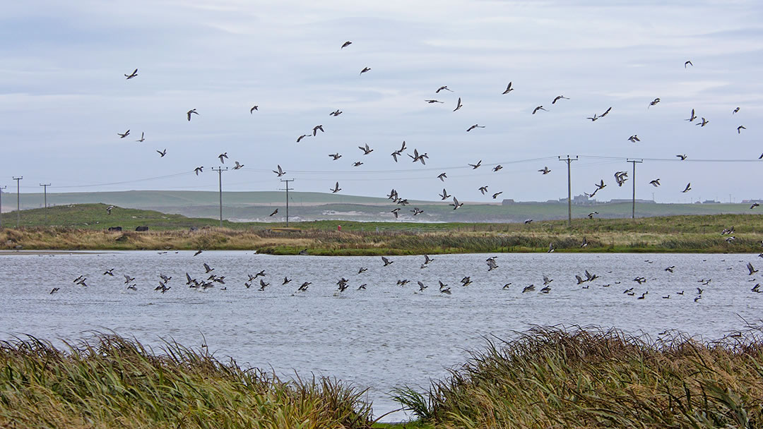
The island of Stronsay is alive with birds. As one of the most easterly of the Orkney islands, it attracts migrants in the autumn and spring. Stronsay Bird Reserve is located at ‘Castle’ on south side of Mill Bay. The bird reserve is owned and run by ornithologist and bird artist John Holloway with his wife Sue. Rare visitors are regularly reported.
Other super places to see birds in Stronsay include the lochs, marshes and heather moorland of Rothiesholm Head which attract breeding waders and ducks, and the Bay of Holland and Burgh Hill (Stronsay’s most easterly and highest point, at 46m above sea level) which attract nesting sea birds in the summer.
The Stronsay Beast
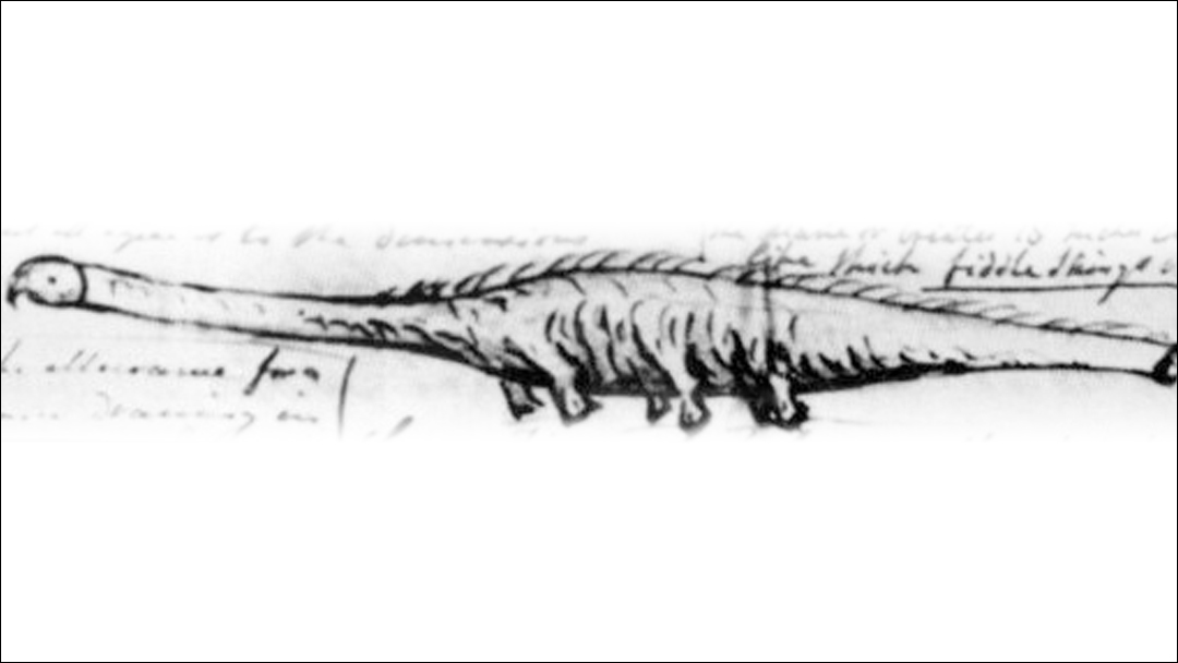
Stronsay had its own Loch Ness Monster – The Stronsay Beast – which was a 55ft-long decomposing corpse of a sea-creature found in 1808. It had a long neck, three pairs of fins edged with bristles, skin that was smooth when stroked head to tail and rough when stroked tail to head, and a mane of bristles all down its back which glowed in the dark when wet!
Though some fancied that the creature was a sea serpent, others declared that it was a basking shark left unrecognisable by decomposition. However, if that were the case, it would be largest basking shark ever found!
Community Spirit in Stronsay
There is a great sense of community spirit in Stronsay. This flat island is ideal to explore on two wheels, and bike hire is free on the island! Well-maintained adult and children’s bicycles and trailers are available from Ebenezer Stores in Whitehall village. To book your bike, please phone ahead!
Also, on Stronsay there is a community greenhouse. This large greenhouse is split into plots much like an allotment which can be hired by islanders for a year to grow fruit, flowers, and vegetables. One plot is used by two ladies to grow flowers to make bouquets given to members of the community on special occasions or if they are feeling poorly.
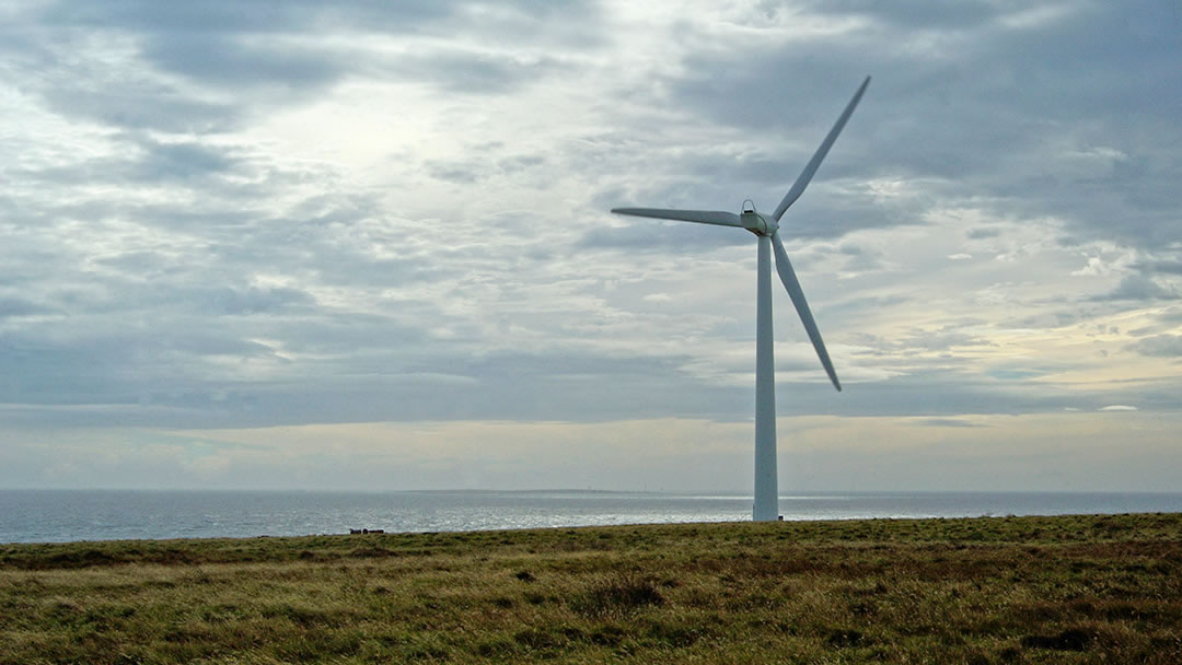
On Rothiesholm there is the Stronsay Community Wind Turbine; is a community-owned 900kw turbine which was erected in 2011. This generates electricity which is sold to the grid and the profits are fed back into the Stronsay community.
Auskerry
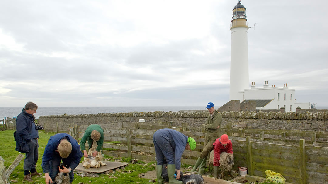
Lying 3 miles south east of Stronsay is a small island with a 34m high lighthouse built in 1866 and automated in 1961. Auskerry contains many archaeological sites (standing stones, burnt mounds, houses and the ruined 12th century St Nicholas Chapel) and has a large colony of Storm Petrels and Arctic Terns. A flock of 300 North Ronaldsay sheep are kept on the island. Strewn on the shore is the wreckage of the British built steam cargo ship, SS Hastings County.
Other Stronsay places to see!
There are quite a few other great places to visit in Stronsay.
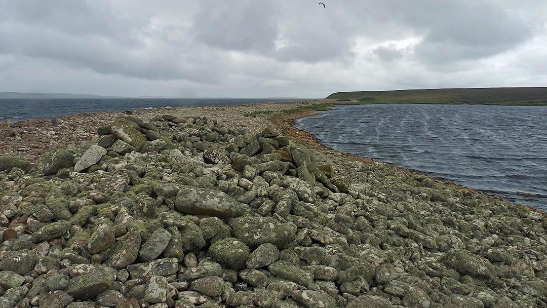
Cobbie Row’s Lade is a pile of stones on the ayre known as Straenia Water close to Rothiesholm Head on the South West of the island. These stones were said to have been dropped by a giant who was building a bridge from Stronsay to Shapinsay!
Out in the waters of Whitehall harbour, there is the wreck of an old concrete barge, lost in 1936. This was a coal hulk which supplied steam drifters during the herring fishery, but it dragged anchors and was driven ashore. For many years after, in the dead of night, local men in small boats took coal from her!
Towards the north of Stronsay (around 2 miles west of Whitehall) is St. John’s Hill. At 43m above sea level it is one of the lowest hills in Scotland, but in a treeless landscape, from here you will still get a fine panoramic view of Orkney’s North Isles.
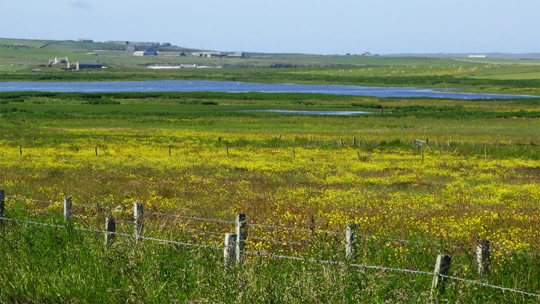
Situated in the middle of Stronsay, the Meikle Water is a large freshwater loch stocked with brown trout (a process that Stronsay school pupils assist with as part of a fabulous educational programme). Fishing in Stronsay is free!
¾ mile south of Whitehall is a mineral water spring called the Well of Kildinguie and these waters were once believed to cure every disease except for the bubonic plague, only if mixed with dulse seaweed from the nearby shore. Pilgrims would travel from Norway and Denmark to partake of the waters, but these days the well no longer flows as it was blocked by quarrying in the 1870s.
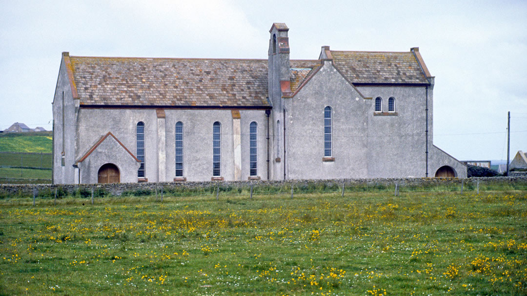
Moncur Memorial Church was built in 1955 after Alexander Moncur passed away and left money to build a church in memory of his grandfather James Moodie, Stronsay’s minister from 1822 to 1860. It has a unique design by Edinburgh architect Leslie Grahame MacDougall but also retains some traditional Orcadian features.
Finally, in the centre of Mill Bay is a rock seat known as the Mermaid’s Chair. A folk tale is told about a storm witch called Scota Bess who would sit here casting spells which caused danger at sea. In effort to stop this, the fisherfolk beat her to death and buried her body. However, in the morning, the corpse was found on the ground beside the grave and this happened several times. Eventually the body of Scota Bess was flung into a nearby loch and never seen again. The Mermaid’s Chair is now a good place to seek out, as any girl who sits here will be able to predict the future!

Find out more at http://www.visitstronsay.com/
 By Magnus Dixon
Orkney and Shetland enthusiast, family man, loves walks, likes animals, terrible at sports, dire taste in music, adores audiobooks and films, eats a little too much for his own good.
Pin it!
