Ten additional hidden gems in Shetland
When it comes to exploring Shetland, especially during the summer months, there are some popular attractions that most people will visit first. While St Ninian’s Isle, Jarlshof and Scalloway Castle are undoubtedly impressive, we wanted to showcase some of the lesser-known but equally amazing places to visit across the Shetland Islands – perfect for repeat visitors seeking new adventures.
Explore the intriguing, yet overlooked, ruins of Burraland Broch which lies almost directly opposite the iconic and well-preserved Mousa Broch.
See also:
- Ten hidden gems of Shetland
- Ten more hidden gems of Shetland
- Ten extra hidden gems of Shetland
- Ten further hidden gems of Shetland
- Another ten hidden gems of Shetland
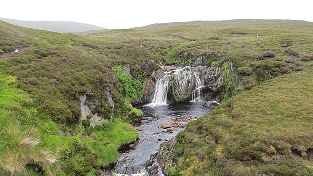
1. The Burn of Lunklet, Central Mainland
The first hidden gem on our list is located about 2 miles northeast of Aith and despite being largely unknown to visitors, the Burn of Lunklet is one of Shetland’s most popular waterfalls.
The walk begins just off the B9071, next to the bridge that passes over the burn; there is a small car park just along the road on the opposite side. The pathway is well-signposted and runs alongside the burn, covering 1.2km there and back.
The main feature of the walk is the waterfall which cascades down a steep rock face. The waterfall is called ‘Ramnahol’, derived from the Old Norn meaning ‘pool of the ravens’ since ravens used to nest on its banks. The surrounding heathery hillsides are a lovely sight and if you’re lucky, you may be able to spot some mountain hare or ravens.
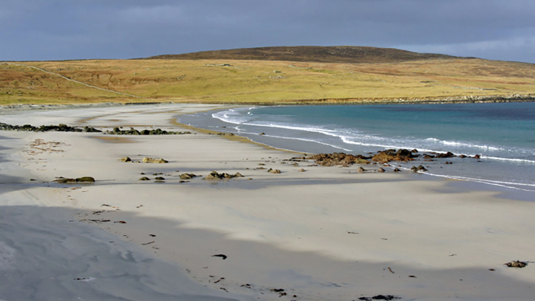
2. Easting Beach, Unst
On the southeastern corner of Unst is a beautiful long white sandy beach that is so secluded that you can almost always enjoy it all to yourself! Easting Beach is ideal for a casual stroll to soak up the peaceful surroundings and wildlife.
Not only is the area visually impressive, but it is also a hotspot for those who enjoy archaeology. The remnants of an Iron Age house can be seen just above the beach on its southernmost end. On the beach itself you can find the remains of a Late Norse farm and a Viking or Norse settlement.
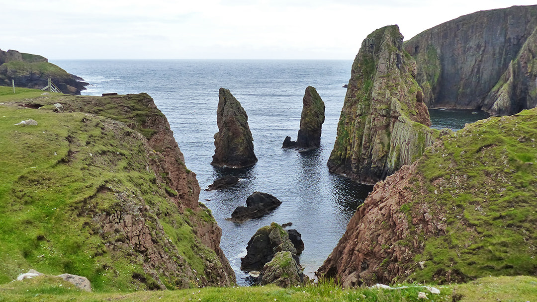
3. Westerwick Coastline, West Mainland
One of Shetland’s best kept secrets is found in the West Mainland. Westerwick’s coastline is filled with spectacular scenery; including towering red granite cliffs, dramatic sea arches and sea stacks, all of which provide the ideal setting for a walk.
The 8.5km stretch of shoreline between Silwick and Westerwick is often regarded as some of the finest in Shetland. There are small beaches and bays in addition to the high cliffs, and the entire region is covered with wildflowers throughout the summer. The rocky cliffs provide the perfect place for a variety of seabirds, especially fulmars and terns, to call home.
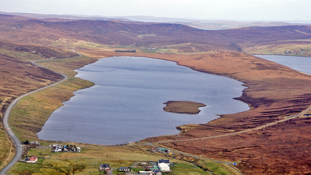
4. The Loch of Girlsta, East Mainland
The Loch of Girlsta is one of Shetland’s largest and deepest freshwater lochs, reaching 65-feet-deep in some spots, and is home to Scotland’s most northerly population of Arctic Char. It’s a beautiful spot to visit, especially on a sunny day!
The loch was named after a Viking Princess, Geirhildr, who ventured out onto the ice-covered water one winter around 1,200 years ago. She tragically drowned after falling through the ice, and local folklore has it that her body was buried on the island in the middle of the lake.
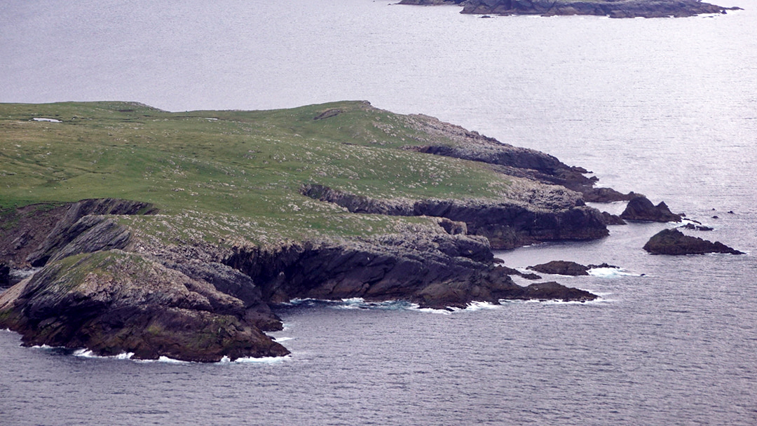
5. Kettla Ness, West Burra
Banna Minn is a beautiful part of West Burra. Minn Beach is a tombolo (a sand or shingle strip connecting an island to the mainland) that is popular with photographers and dog walkers, and it links to the wild and intriguing Kettla Ness peninsula.
Kettla Ness is an excellent location for a coastal stroll. The headland boasts stunning sea vistas from its clifftops, which reach up to 160 feet tall in places. This linked island is home to only seals, otters, seabird colonies (including Arctic Terns and Arctic Skuas), and sheep, but it historically supported multiple agricultural villages.
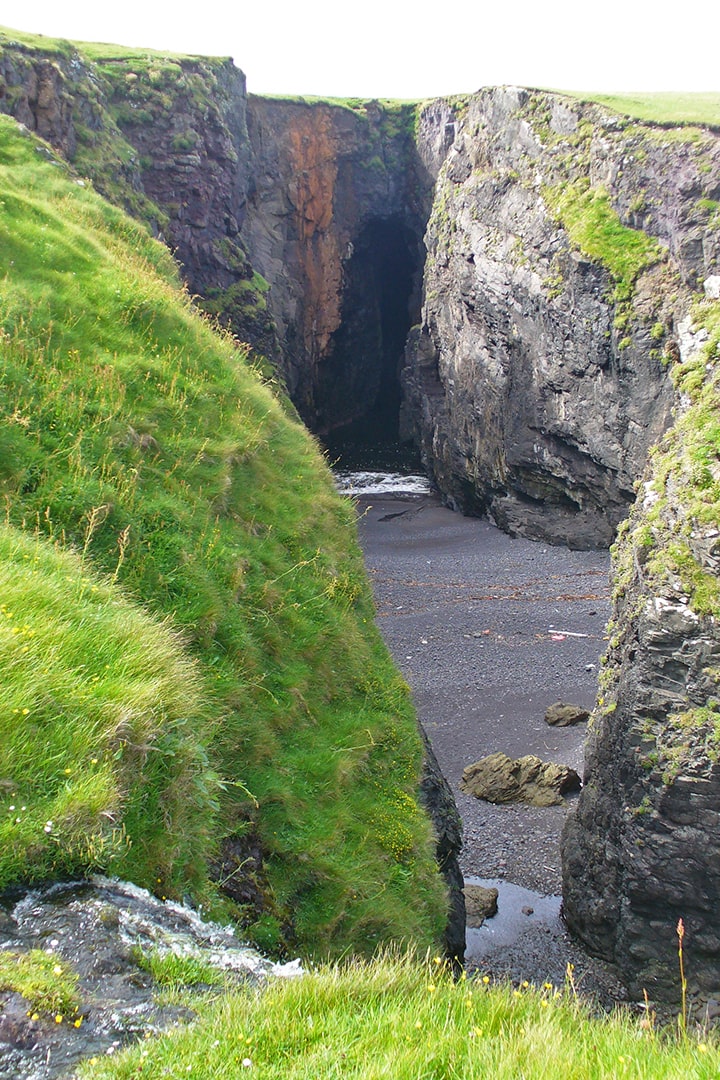
6. The Holes of Scraada, Eshaness
Eshaness features the flank of an ancient volcano whose rock has been eroded by the power of the Atlantic Ocean. Eshaness is another popular destination for walkers looking to take in the breathtaking scenery of Shetland’s shoreline. The Holes of Scraada, which can be reached by walking around a mile from the Esha Ness Lighthouse, are particularly impressive.
The Holes of Scraada are a collapsed sea cave that is still connected to the sea by a 100m tunnel. Despite there only being one hole seen today, it is known as the holes because at one time there were two holes that were separated by land bridge. However, in the early 20th century, it collapsed leaving one large void in the land.
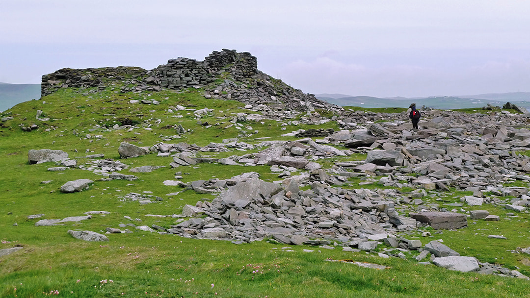
7. Burraland Broch, Sandwick
Burraland Broch is located on the western bank of Mousa Sound, nearly immediately opposite the famed Mousa Broch, which has been extraordinarily well preserved. The Broch of Burraland, on the other hand, has not fared as well throughout the years, and is now mostly in ruins.
The cliffside hike to Burraland Broch is an adventure in and of itself, taking around an hour from Sandwick Pier. Aside from the opportunity to explore the ruins, you will be rewarded with breathtaking sea views out towards Mousa and beyond. The location is particularly excellent for wildlife spotting, with numerous seabirds and even harbour porpoises can be seen!
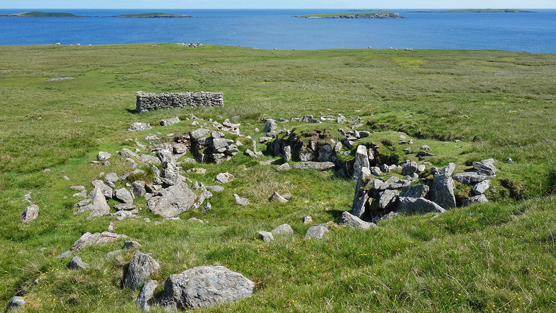
8. Benie Hoose, Whalsay
Benie Hoose is a fascinating Neolithic site on the island of Whalsay in the parish of Nesting. The name is said to be a local phrase for a ‘Bone House’ or graveyard, or it might be derived from the Old Norse ‘Boenhus’, which means ‘a place of prayer’ or chapel. The home is said to have been used as a dwelling for priests who performed worship at the Standing Stones of Yoxie, which are located about 100 yards northwest of Benie Hoose.
Charles Calder excavated the site in 1954-1955, and the results he uncovered were both surprising and astounding. He discovered approximately 1,800 items, including axes, hammerstones, and pounders, as well as shattered pottery, indicating a lengthy period of occupation.
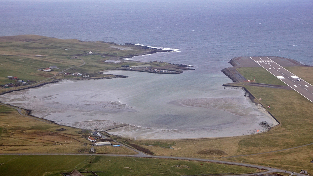
9. The Pool of Virkie, South Mainland
The Pool of Virkie, located on the southern tip of Shetland’s Mainland, is barely a half-mile north of Sumburgh Airport. It is a scenic bay that has become an important destination for bird watching due to the huge area exposed by the ebb tide. Many bird species may be seen here throughout the year, including skuas, gulls, greenshanks, ringed plovers, and dunlins.
The Pool of Virkie once functioned as the principal Hanseatic League trading location in the south end of Shetland some 400 years ago, when the pool was much deeper than it is today. The Hanseatic League was a prominent trading network in northern Europe.
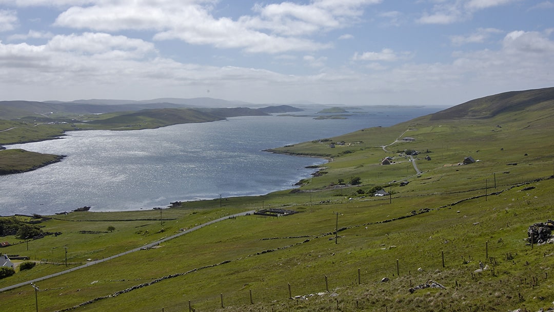
10. The Scord of Weisdale, Central Mainland
The Scord of Weisdale is viewpoint which offers simply outstanding views across to Kalliness and the Hill of Hellister. The designated viewpoint is a lay-by located along the A971, which can be found after following the road round the Weisdale Voe.
If you are in the area, it is well worth having a quick stop here to appreicate the rolling hills and stunning scenery – don’t forget your camera!
 By Amy Leith
Born and raised in Aberdeen with an admiration for Orkney and Shetland, loves to travel and visit new places, enjoys cooking, always listening to music, spends a little too much time on TikTok.
Pin it!