Ten additional hidden gems of Orkney
The wonderful thing about the Orkney Islands is that there is never any shortage of interesting places, beautiful beaches, dramatic scenery, or archaeological sites to visit. For the first time visitor, the most well-known Orkney places such as Skara Brae and the Ring of Brodgar are must-sees. For those visiting for their second time, for islanders, and for those who are keen to see something a little different, we have compiled this list of Orkney hidden gems!
Many visitors to Birsay walk from the car park next to the Brough of Birsay east to Northside and the whalebone at Skipi Geo. For a superb Orkney hidden gem, we would urge you to venture a half a mile further along the shore to dramatic Langalebe Geo.
See also:
Ten hidden gems of Orkney
Ten more hidden gems of Orkney
An extra ten hidden gems of Orkney
Ten further hidden gems of Orkney
Another ten hidden gems of Orkney
Ten new hidden gems of Orkney
Ten other Hidden Gems of Orkney
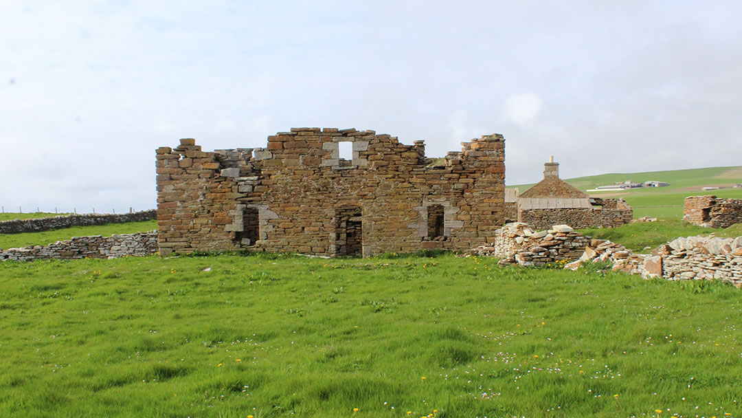
1) Breckness, Stromness
Breckness is on the shore just outside Stromness and a visit here makes for a fine walk on a sunny day. The closest place to park is a mile away at Warebeth beach. On your walk above the shore there is a stunning view of Hoy Sound and the Hoy Hills to the south and to the north, Breckness House is visible in the distance.
When you reach Breckness House, although it is now a ruin, you will see that it was once a very grand building. It had a kitchen with two large fireplaces and a long and stately dining hall. It was built in 1633 by Bishop George Graham. Graham’s descendants own The Breckness Estate which includes Skaill House in Sandwick, and Skara Brae Neolithic village.
Several buildings surround Breckness House including farm buildings, a chapel, burial ground, and a broch (though only a short arc of the broch wall remains, as it has been nearly entirely demolished by coastal erosion). The name Breckness possibly comes from the Old Norse word, ‘brak’, meaning a crash or a noise, and ‘ness’ means point. On a wild day, the sea crashes onto the shore nearby.
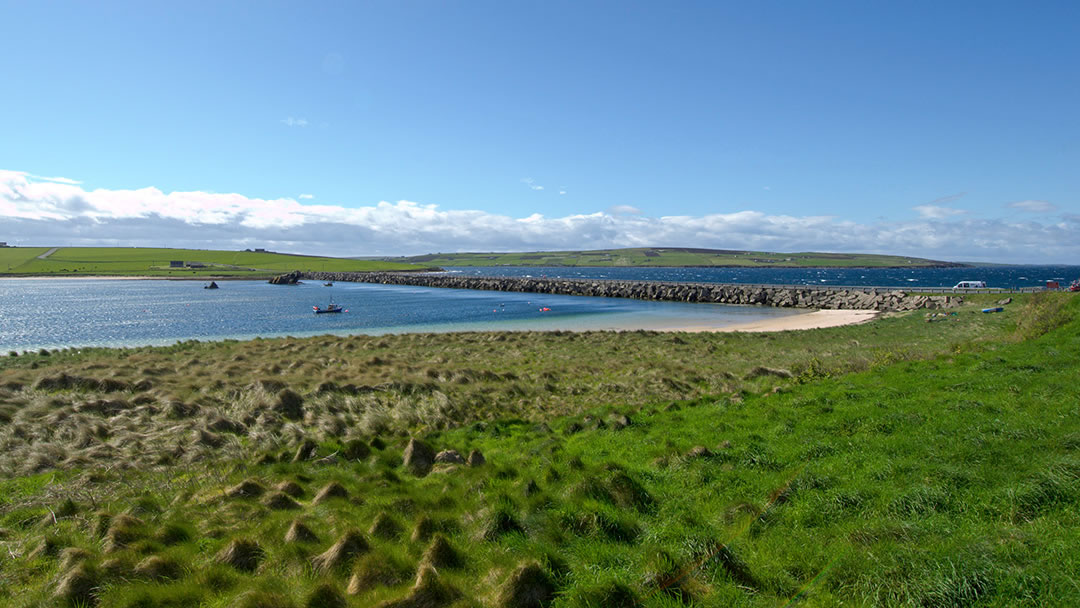
2) The beach at Churchill Barrier Number 3
A hidden gem of a beach is nestled next to Churchill Barrier Number 3 on Glimps Holm, and it has beautiful soft white sand and a most striking view of a sunken blockship, SS Reginald. This ship and many more were sunk around 1915 to prevent enemies reaching the British Fleet in Scapa Flow. Disaster struck at in 1939 when an enemy submarine managed to sneak through. The battleship HMS Royal Oak was destroyed, 835 lives were lost, and work began on the Churchill Barriers, to better defend Scapa Flow, soon afterwards.
1/4 million tonnes of rubble was laid as foundation for the Churchill Barriers between the south isles. Then 66,000 blocks, weighing 5 or 10 tonnes each were laid on top. A road now runs over the top of the barriers, joining these islands together seamlessly. Much of the work was undertaken by prisoners of war and their place of worship, the Italian Chapel, is a popular visitor attraction on Lamb Holm. Sand has accumulated against the barriers and divers train here frequently. This beach at Weddell Sound is a truly lovely place to be on a sunny day.
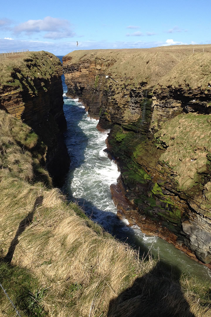
3) Langalebe Geo, Northside, Birsay
Many visitors to Birsay walk from the car park next to the Brough of Birsay east to Northside and the whalebone at Skipi Geo. For a superb Orkney hidden gem, we would urge you to venture a half a mile further along the shore to dramatic Langalebe Geo.
The exposed cliffs and rock formations here are of great interest to geologists and the view out north towards Westray is very fine. This impressive coast is part of a St Magnus Way walk. Langalebe geo is the result of coastal erosion which has cut a deep gorge 200m inland from Whitaloo point. The sea surges and boils in Langalebe geo and the cliffs are covered with seabird nests, so be sure to take your camera along! The Langalebe Geo cliffs are fenced off so it’s quite safe for nervous folk. You can either return the way you came or take the road back west through Northside.
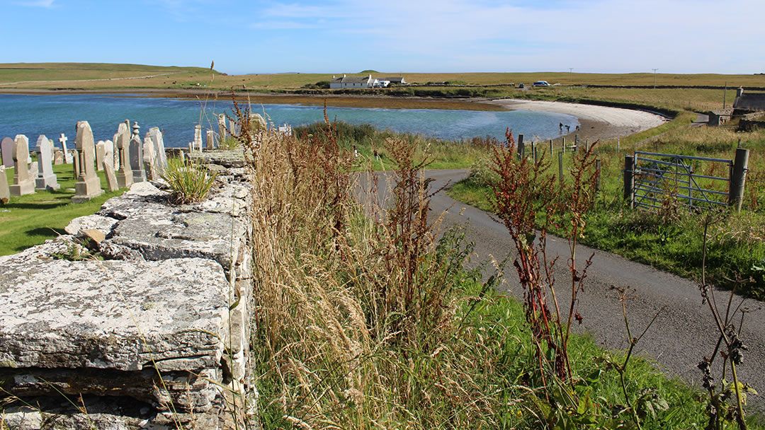
4) Osmondwall, South Walls
One of the most tranquil corners of the island of Hoy is also associated with some of Orkney’s most dramatic stories. Osmondwall was one of the first sheltered bays that ships met in the Pentland Firth and so it was popular with early settlers. At Osmondwall there are Neolithic and Bronze Age burial sites, a broch, a lovely beach and Cantick Head Lighthouse, which was first lit in 1858.
It was at Osmondwall that Earl Sigurd the Stout was forcibly baptised into the Christian faith. Sigurd refused to give up the old faith until King Olaf Tryggvason threatened him with execution. Olaf also promised to ravage Orkney ‘with fire and steel’ if Sigurd did not covert. There is a fine carved stone bench in the Osmondwall kirkyard which tells the story.
The Longhope Lifeboat Memorial is also in the Kirkhope burial ground. This is a lone bronze statue of a lifeboat crewman created by North Ronaldsay sculptor Ian Scott. In 1969, the Longhope Lifeboat, the T.G.B, was lost in a storm en-route to a rescue. Eight men, drawn from four families perished, and they were: Coxswain Daniel Kirkpatrick, Second Coxswain James Johnston, Bowman Daniel R. Kirkpatrick, Motor Mechanic Robert R Kirkpatrick, Assistant Mechanic James Swanson, Life-boatman Robert Johnston, Life-boatman John T. Kirkpatrick and Life-boatman Eric S. McFadyen. This is a very poignant memorial to them.
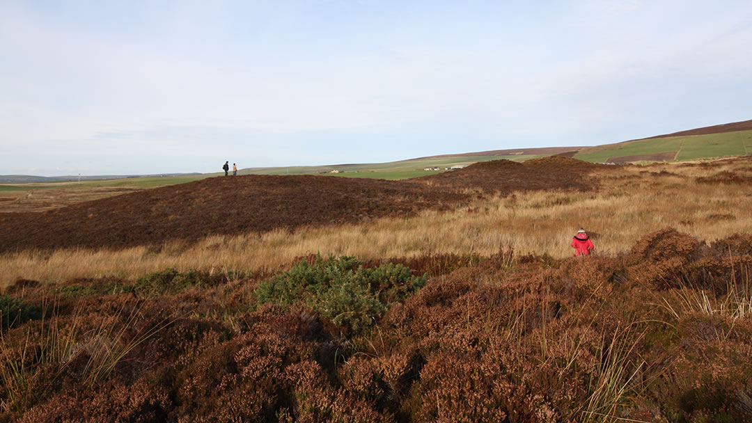
5) The Knowes of Trotty, Harray
The Knowes of Trotty are ancient burial mounds in Harray, and it is a shame that this very important archaeological site is not better known. Perhaps it is because the largest bronze age burial site in Scotland is tricky to visualise and because it requires a bit of a hike along a track through heather. To visit, start by turning off the A986 road to Dounby on to Howe Road and walk up to Winksetter farm. Continue to the left, and though the path is sometimes hard to spot, boardwalks over the wettest patches will keep you right.
There are two lines of giant burial mounds which have been carefully located so that the beautiful open landscape of the West Mainland lies before them. Only one of the mounds has been fully excavated and inside were found cremated remains from 2000BC-1600BC. The individual was wealthy and fashionable with access to rare and expensive materials. Four gold discs (button covers made using an English technique using Scottish gold) and an amber necklace (again similar to finds from England and made using amber from the Baltic) were amongst the possessions found.
The name ‘Knowe’ refers to burial mounds and ‘Trotty’ means trow marsh. In the past, Orkney folk believed that evil trolls lived in the burial mounds that appear throughout the isles. Read more about the Knowes of Trotty.
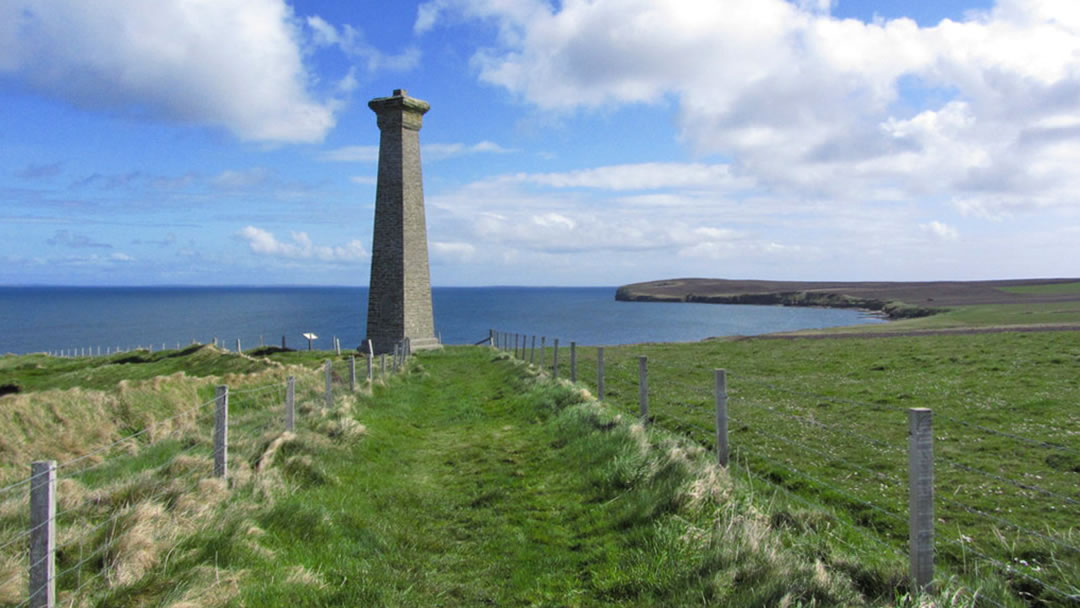
6) The Covenanters Memorial, Deerness
In the north eastern tip of Deerness there’s a monument to a shipwreck which claimed the lives of 200 religious prisoners in 1679. The Covenanters believed in the sovereignty of God and rebelled against King Charles II. They were captured after the Battle of Bothwell Bridge, and were to be transported to the New World, where they would be sold as slaves in Barbados.
Before the journey had barely begun, their ship ‘Crown of London’ was driven onto the rocks below where the Covenanters Memorial stands today. The crew battened down the hatches, locking the prisoners below deck to prevent the Covenanters from rescuing themselves. One crew member defied orders and hacked through the deck with an axe but only 50 Covenanters survived. Though many were rounded up to continue their journey, some survivors managed to settle in Orkney, becoming crofters in Rackwick.
There is a car parking area a mile inland and a fine walk to the coast and memorial. The view of the north isles is very fine, and the adventurous can visit as part of a circuit, taking in Mull Head, the Brough of Deerness and the Gloup also.
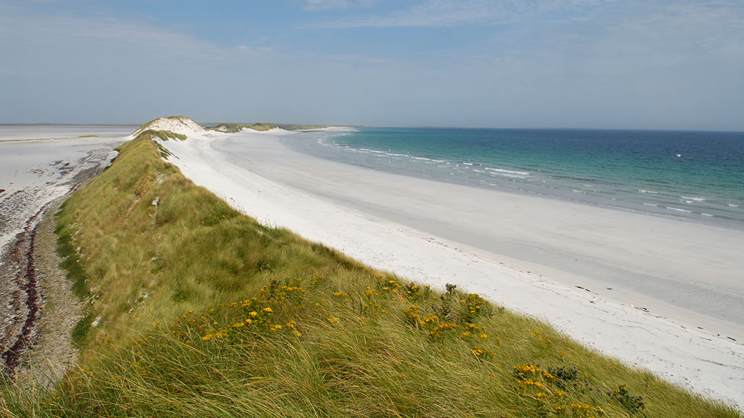
7) Tresness, Sanday
Tresness is located close to Lady Village in Sanday, and we think it is a hidden gem for a number of reasons. The first reason is a square concrete ruin called the brickie hut which is found at the start of a walk to Tresness. In WW2 this was part of a decoy airfield which was designed to distract enemy aeroplanes away from Scapa Flow. As you make your way along the coast of this thin peninsula there is a high bank of sand dunes, and this stunning landscape is the second reason we like Tresness so much. We recommend the young at heart take a sledge to best enjoy these slopes!
The sand dunes hold in a sea loch, called Cata Sand, which become sand flats when the tide is out. The mouth of Cata Sand called the Clogg, and should not be crossed as the water here is deep! Once you reach the island at the southernmost tip of Tresness you will discover the third and final reason to visit -archaeology. The ruins of the Wasso Broch and an eroding chambered tomb are quite intriguing!
8) Site of the Battle of Summerdale
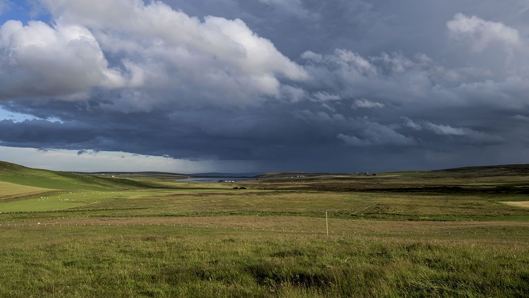
The Germinston road links branches off the A965 Stromness to Kirkwall road and meanders through a quiet valley to meet the A964 road from Orphir to Kirkwall. It is hard to believe that close to the Loch of Kirbister, this tranquil landscape was the site of the last pitched battle in Orkney in 1529.
At that point in the island’s history, Orkney had in 1468 ceased being a part of the Scandinavian Kingdom and was now a remote province of Scotland which was treated badly by Scottish rulers. Islanders, rebelling against taxes and an abusive Scottish ruler, seized Kirkwall Castle, and in retaliation the army of King James V, led by the Earl of Caithness landed at Orphir. It was there, on the border of Stenness and Orphir, that the Orkney rebels swarmed out of the hills and cut the invaders to pieces.
There are two gripping stories from the Battle of Summerdale. The first was that, before the battle, a witch made a prophesy that the first army to spill blood would be defeated. After landing in Orkney, the Caithness army killed a young herd boy, who was the first unfortunate islander they met. However, they discovered later that the boy was originally from Caithness. The second story involved the only Orkney man to be killed that day. After the battle, the man had stripped the uniform from a dead Caithness soldier and returned home. His own mother, believing him to be the enemy, struck her son with a stocking filled with stones.
Following the Battle of Summerdale, the King of Scotland pardoned the rebels. Later King James visited Orkney and a peace was struck which was never threatened again.
9) Burgar Hill, Evie
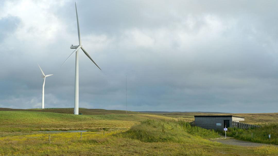
Burgar Hill in Evie overlooks dramatic moorland on one side and the island of Rousay on the other. It is probably best known as the site of experimental wind turbines in the 1980s, including a 3MW wind turbine, the largest in the world at the time. This has now been demolished, but there are several wind turbines here which are run commercially, and a trip to Burgar Hill to stand beneath their massive whooshing blades is recommended.
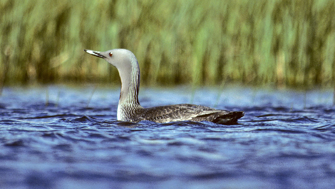
Burgar Hill is also part of the Birsay Moors RSPB reserve, and there is a small loch nearby called Lowries Water which attracts very rare red-throated divers despite the presence of monstrous wind turbines nearby. There is a very fine bird hide at Burgar Hill ideal for viewing observing red-throated divers, which are known as the ‘Rain Goose’ because of their mournful calls and striking grey plumage.
10) Olav’s Wood
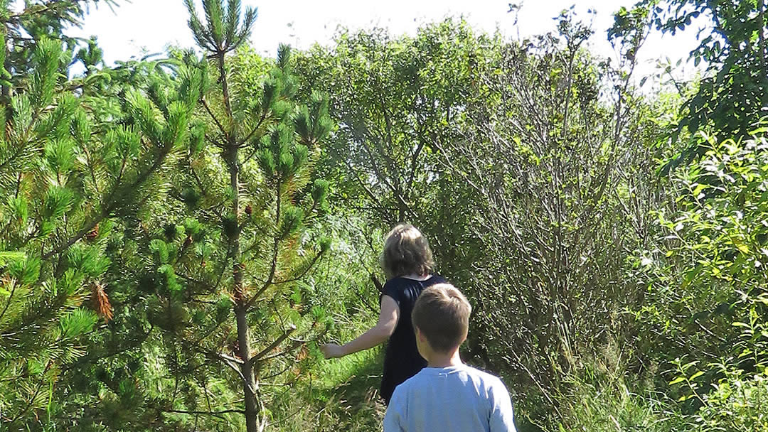
In South Ronaldsay there is a great treat for bairns and adults alike – a wonderful woodland to explore. It is located on the road to Windwick Bay (which is also a super place to visit) and Olav’s Wood is a completely man-made tree plantation.
In the 1970s Helen and Stephen Manson and Olav Dennison planted various trees along a trickling burn. There are many trails to explore, though there is no need to worry about the path you choose to take, as they all go in roughly the same direction. These paths are named after the hard workers who have maintained Olav’s Wood over the years. There is a thick pine forest which is particularly atmospheric, where teapots have been hung from tree branches as makeshift birdhouses.
 By Magnus Dixon
Orkney and Shetland enthusiast, family man, loves walks, likes animals, terrible at sports, dire taste in music, adores audiobooks and films, eats a little too much for his own good.
Pin it!